Republic of Bashkortostan
Republic of Bashkortostan (bashkir. Башҡортоста́н Респу́бликаһы) - Republic, subject of the Russian Federation. According to the Russian Constitution and the Constitution of Bashkortostan is Respubiki state. Included in the Volga Federal District, as part of the Ural economic district.
Borders - with Tatarstan, Udmurtia, Perm Territory, Sverdlovsk, Chelyabinsk and Orenburg regions.
Founded - March 23, 1919.
According to the Constitution of the Republic of Bashkortostan of the name "Republic of Bashkortostan" and "Bashkortostan" are equivalent.
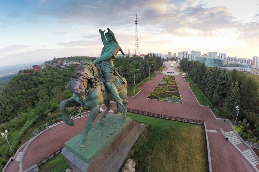
Capital - the city of Ufa (founded in 1574)
Geographical position
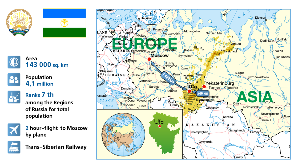
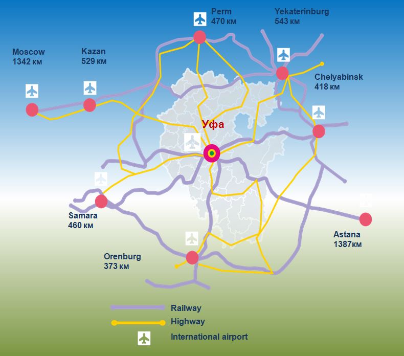 The Republic of Bashkortostan is located in the southern Urals and adjacent areas - Urals and Trans-Urals part. Area = 143.6 thousand sq. km. The length of the territory from north to south = 550 km, from west to east = 430 km. The population is over 4 million Pers.
In the west, on the border of Bashkortostan and Tatarstan and Udmurtia in the north - with Perm and Sverdlovsk regions in the east - with Chelyabinsk region in the south - with the Orenburg region.
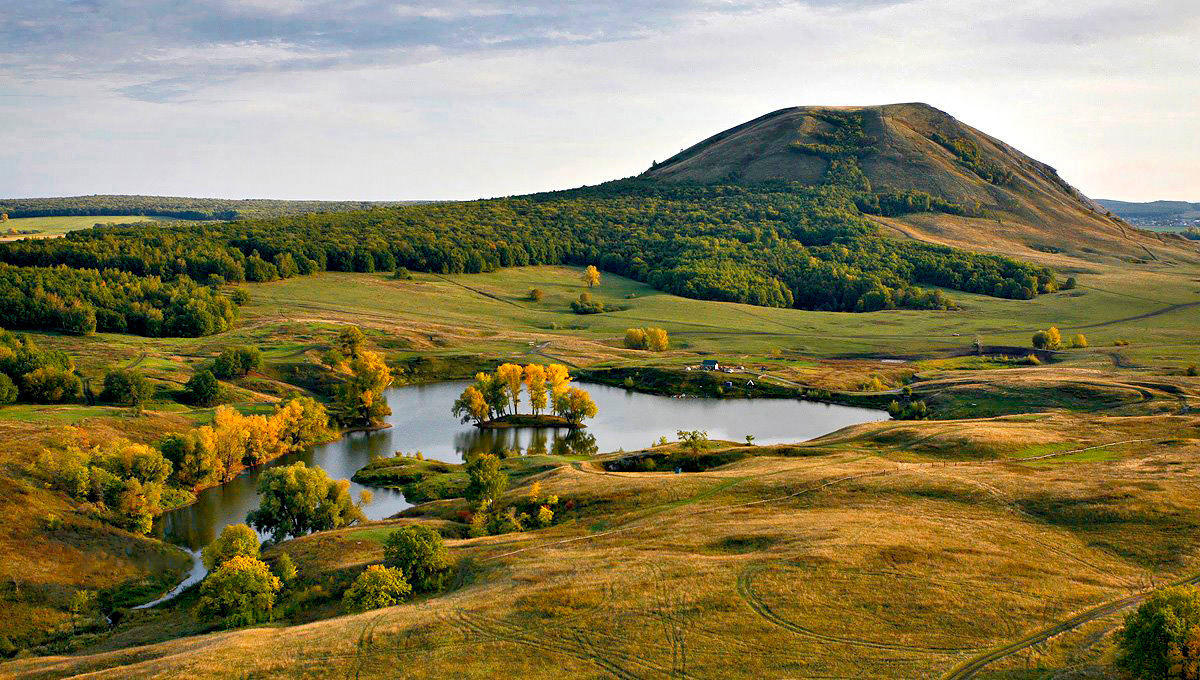
Bashkortostan is characterized by the diversity of natural conditions, and clearly divided into 3 main areas:
Bashkir Urals - 2/3 of the entire territory. The hilly plain. The most favorable for the life and activities of the population.
Mountain Bashkir Urals - more than 1/4 of the territory. Less favorable area for human life and activities.
Bashkir Trans-Urals - 1/10 of the entire republic. A narrow strip, which moves in the West Siberian Plain.
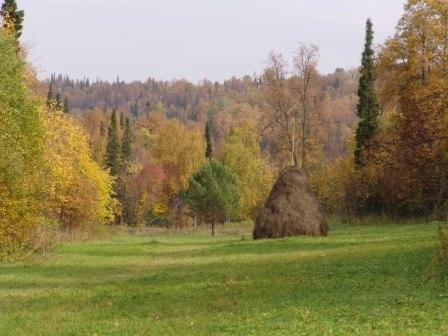
Natural conditions are favorable for the development of agriculture and industry. Large areas occupied by black soil rich in forests. The rich minerals and water resources (surface and underground). The favorable agro-climatic resources. Bashkortostan is in good settlement and development of Russian zone.
Development of the Republic promotes geographical location itself. Here are the most important railways, pipelines and highways connecting the European part of Russia with the Urals and Siberia. In Bashkortostan direct access by rail to Kazakhstan, Uzbekistan, the Lower Volga, Turkmenistan.
White River - part of a single deep-water system of Russia, Belarus provides access to the ports of the Caspian, Baltic, Black Sea and Azov basins.
Bashkortostan has a positive opportunities for import and export as raw materials and fuels, and finished goods - the western and eastern regions of the country.
The most important feature of the geographical position of Bashkortostan is that it is located at the crossroads of not only two continents, but also at the junction of 2 economic regions (the Volga and Ural) and connects them. Historically Bashkortostan has a close relationship with the surrounding regions of the Ural. Bashkortostan is a part of the Ural economic district. The proximity of Bashkortostan with highly developed regions of the Urals and the Volga region is one of the favorable factors of its geographical location.
RB Landscapes include:
mountains and plains;
taiga and steppe feather grass;
excessively wet and dry terrain sharply; etc. This is due to physical and geographical location. Bashkortostan in nature combines the features of various adjacent spaces.
Flora and fauna is a patchwork of the Volga-Kama, Ural and Siberian and Kazakh species.
The territory of Bashkortostan stretches from north to south and has four geographical areas, temperate zone:
zone of mixed forests;
deciduous forests;
steppe zone;
steppe zone.
Additional natural diversity gives the Ural Mountains, which stretch across the whole country wide strip, the landscape changes from the steppes at the foot of the mountains, to the taiga at an altitude of 600 - 1000 m, and goltsy belt on the highest peaks.
Surprisingly varied terrain of Bashkortostan: Plain; rolling plains; upland; plateau; plateau; mountain ranges; intermountain "depression" (reduction). This is due to the geographical structure of the territory. It covers part of heterogeneous tectonic formations.
MAIN:
Russian Platform (eastern suburb);
Preduralsky deflection;
Ural folded region (country)
The surface of the Western Bashkortostan is pologovolnistuyu, sometimes hilly, plain with an average altitude of 150 - 300 m.
Bugulma - Belebei hill maximum height = 480 m.
Ufa plateau - the maximum height = 517 m.
Pribelskaya plain and Yuryuzano-of Ai - northeast of Bashkortostan.
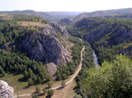
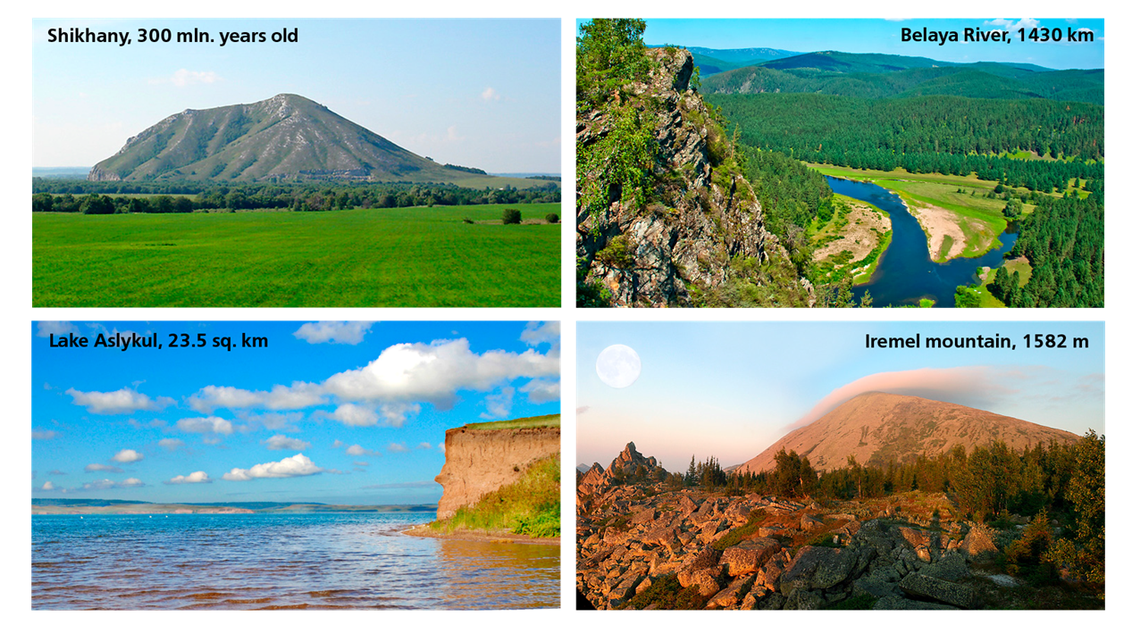
Mountain Bashkortostan occupies the southern Urals in relief - a system of mountain ranges, which are separated by intermountain depressions. The main ridge is considered - Ural-Tau - not the highest, but it is a watershed (1 km no higher), Avayak, Mashakah - up to 1.5 km altitude are the highest peaks of the Urals. Iremel height = 1584m, Yaman-tau height = 1640m. Maximum length - 190 km.
To the south of these ridges are reduced and transformed into Zilair plateau. The slow movement of the Southern Urals continued mainly in height.
Bashkir Trans-Urals - stretches a narrow strip - this ridge-hilly places Sopochnaya. Urals due to the presence of various minerals. Bashkortostan has:
Fossil Fuels;
ore, metallic minerals;
non-metallic minerals;
The groundwater.
By species - raw materials Bashkiria is superior to all other countries. There are over 3,000 species of minerals.
The climatic and hydrological conditions
RB territory is located in the heart of the continent. The air masses from the Atlantic come here more transformed (ie, less wet, colder). From the north of the republic opened wide influence of the Arctic Ocean. From south to Bashkortostan affect arid regions of Kazakhstan, the Caspian depression. Low Ural mountains do not interfere with the effect of the cold of Siberia - is determined the continental climate of Bashkortostan.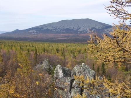
The climate is characterized by:
warm summers (sometimes hot);
long cold winter.
This is due to:
annual progress of solar radiation;
change the radiative properties of the Earth's surface during the year;
circulation processes (air masses) - cyclonic activity, the nature of the impact of these different masses.
In Bashkortostan affect air masses from the south, continental heat of Central Asia, a sharp change in weather, impermanence.
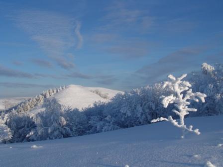
West of Bashkortostan - a zone of moderate continental climate. The western slopes of the Ural Mountains the most moist. The eastern slopes and in the Urals - dry, dominated by purely continental climate. Mountain Bashkortostan - the most precipitation up to 600 mm. With a height decreases temperature decreases year frost-free period, at an altitude of about 1,000 meters and a large winter to 1.5 months longer. Moderately cold climate.
The average annual temperature in Bashkortostan +2.8 ° C.
The average July temperature is + 17-19 ° C; January - 15-17 ° C.
The stable transition temperature through zero in the first decade of April, up, down the third decade of October. Uneven distribution of precipitation.
An important factor - it's a breeze. The wind regime is determined by the seasonal features of the atmospheric circulation. The cold - gain, the most re-south and south-west. In the summer there are calms, northern winds.
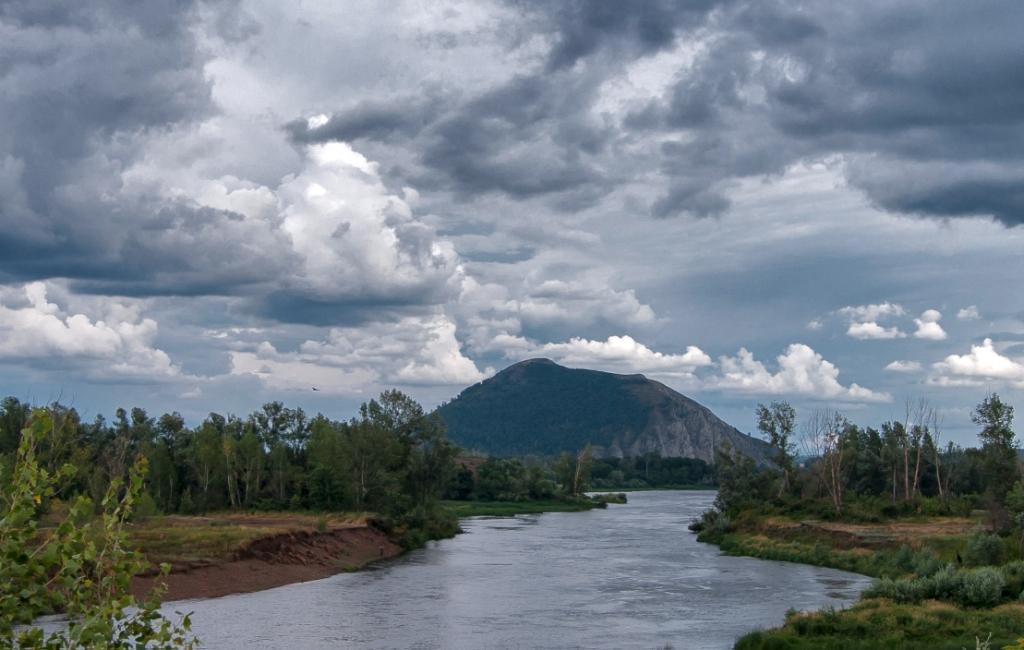
Bashkortostan is rich in surface waters. Numerous rivers and lakes adorn its nature. The country has about 13,000 rivers of their length of 57,000 km. The main portion has a length less than 100 km.
The entire river network belongs to the 3rd river systems:
Volga system;
Ural system;
Ob system (less than 1% of the territory, the Greeks, Uy, meats);
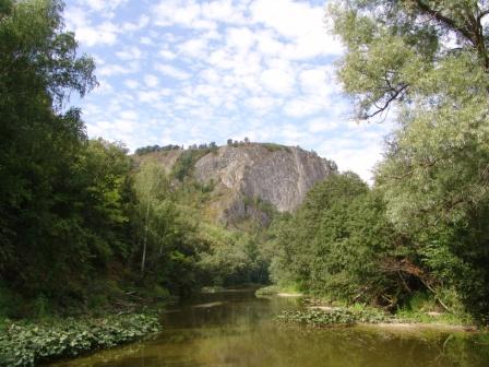
The main river - White 1430 km; source at Mount Iremel, the channel increased to 1.2 km, the main part of the water consumption - 920 cubic meters. m / sec. The main tributary of the White - p. Ufa; 918km length. Deep valley cuts through the Ufa plateau. Reservoir Pavlovian - 120 square meters. km. Major rivers Dema - 556 km; Ai - 549 km. The main rivers are the source of power: precipitation and groundwater.
In Bashkortostan, more than 1,000 lakes (including reservoirs).
Large:
West - Aslı cul (more than 23 sq. Km), Kandra-Kul.
Trans-Urals - Urgun, Big Uchaly, Jakty-Kul, Chebarkul, Talkas.
The origin of the lakes is different. West, located in the valleys that are formed as a result of Karst encroachments, as a result of Trans-Ural - tectonic. Most of the lakes are very small - floodplain, oxbow.
Temperature
The number of sunny days per year ranges from 287 to Aksyonovo and Beloretsk Ufa to 261 (least number of days is in December and January, the largest - in the summer months).Average absolute minimum of air temperature is -41 °, the absolute maximum of + 38 °. The stable transition of air temperature over 0 ° takes place 4-9 April in spring and October 24-29 - in the autumn, in the mountainous areas respectively on 10-11 April and 17-21 October. The number of days with positive air temperature of 200-205, 188-193 in the mountains. The average date of the last frost in May 21-30, the late June 6-9, and in the northern and mountainous regions - June 25-30. The average date of first frost in September 10-19, the earliest - 10-18 August.
Precipitation
The annual precipitation is 300-600 mm of rainfall, there is a fairly sharp differentiation deposits on the territory of the republic, and their number thus depends primarily on the nature of the atmospheric circulation. Especially strong is the influence of the Ural Mountains. On the western slopes of the Ural mountains annual precipitation reaches 640-700 mm, on the eastern slopes of not more than 300-500 mm, in the western plains of the Bashkir - 400-500 mm. 60-70% of the precipitation falls during the warm season (April to October). In the summer months accounts for the maximum daily rainfall (78-86 mm).Snow cover
The earliest date the appearance of snow cover 12-20 September, the earliest date of the formation of stable snow cover - On October 16-24, in the mountainous regions in October 5-12, the mean date of snow cover - 3-13 November. Average date of snow cover 14-24 of April. The number of days with snow cover is 153-165, in mountainous areas - 171-177. Average and maximum height of 36-55 cm of snow, the maximum height can be up to 106-126 cm. The average density of the snow cover at the highest altitude of 240-300 kg / m3.Flora and fauna
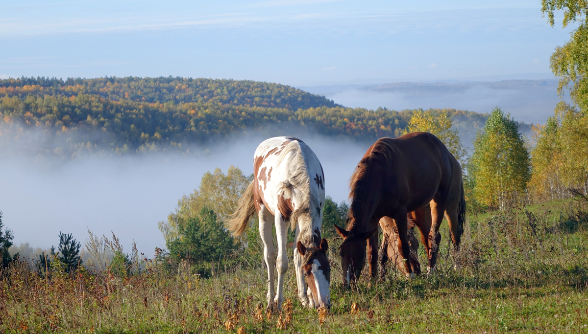
Forests cover more than 40% of the territory of the republic. The Urals is a mixed forest, to the north, in the western foothills, located deciduous and pine-birch forest and dark coniferous taiga.The Urals are also common forest with birch and oak forests, mixed grass-feather grass steppes.
Soils are mostly gray forest, chernozem, sod-podzol.
In the rivers, lakes and ponds of the republic inhabited by 47 species of fish, 13 of them listed in the Red Book of Bashkortostan. These include sturgeon, sturgeon, trout, brook trout, European grayling. More prevalent bream, white eye, chub, ide, roach, bream, rudd and perch, ruff and pike. There are catfish, eel, sprat, Buckley.
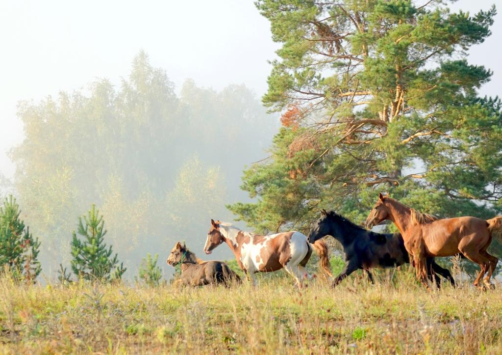
On the territory of Bashkortostan live 286 species of birds, 76 species of mammals, 700 species of worms, 121 kind of shellfish, about 500 species of arthropods, 10 species of amphibians and reptiles as well. The fauna is quite diverse edge. Many species of animals and birds have an extensive habitat zone, although the spread of some European species limited the Ural Mountains.
Among the mammals in the southern regions there are small pika, gray hamster, and Eversmann, and on the left bank of the Belaya River meets reddish gopher. However, most animals inhabit the entire territory of the republic: marmot, jerboa, hare, steppe polecat, gray partridge, skylark, bear, lynx, marten, chipmunk, squirrel, grouse, beaver, otter, muskrat, various kinds of ducks and gulls, eared turtle, moose, roe deer, wild boar, and many others.
Objects of hunting are now mainly duck:. Teal and hazel grouse, black grouse, grouse, woodcock and other hunted marten, mink, ermine, weasel, pale weasel, badger, wolf, fox, raccoon dog, a hare.
Strictly according to certain standards, made production of elk, wild boar, bear and beaver, as a result of deforestation, pollution of water bodies and fields, their number has fallen dramatically. Gone are many species of birds - in Bashkortostan stopped nesting pelican, shelduck, little bustard, bustard, steppe eagle, completely cut off muskrat. The Red Book of Bashkortostan made some species of birds of prey, reptiles, mammals and insects.
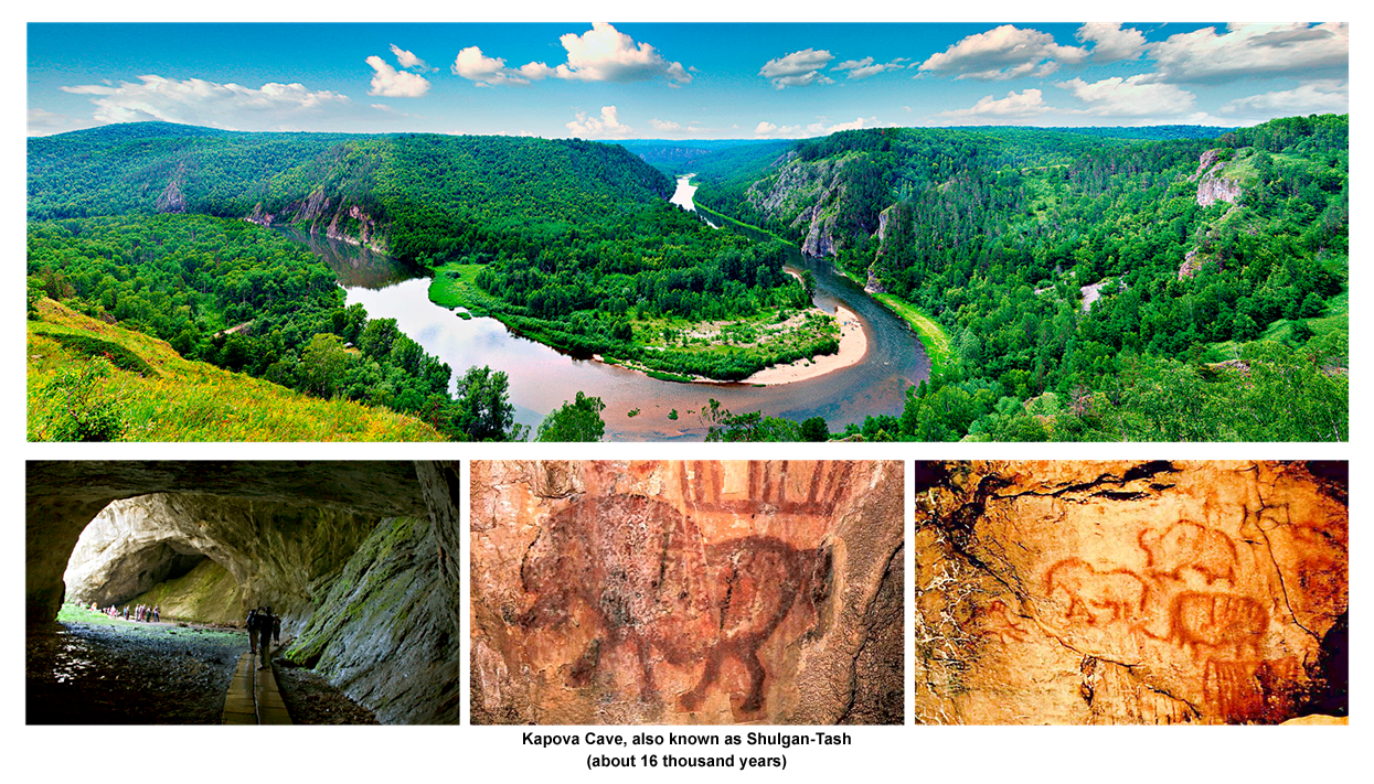
In order to preserve natural complexes created "Bashkiria" National Park, Bashkir Reserve, South Ural Reserve Reserve Shulgan-Tash.
Timezone
Bashkortostan is in the time zone designated by the international standard as Yekaterinburg Time Zone (YEKT / YEKTST). Displacement concerning UTC makes +5: 00 (YEKT, standard time) / 6: 00 (YEKTST, summertime) as in this time zone for daylight saving time. Concerning Moscow time the time zone has constant displacement +2 hours and is designated in Russia correspondingly as MSK + 2. Yekaterinburg Time differs from the lap time by one hour as daylight savings time acts on the territory of Russia.Tourist resources
76 sanatorium organizations in which treated and resting more than 250 thousand people annually.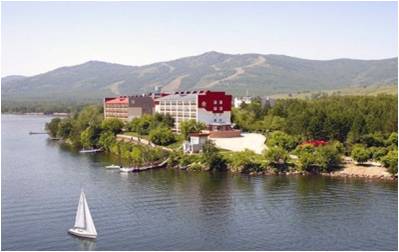
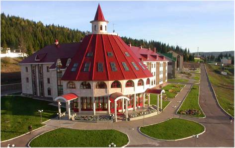
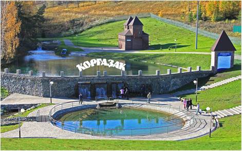
In accordance with recreational potential, historical and cultural features, the republic can be divided into 7 zones of rest, the majority of which are already mastered and function.
Central area with a center in Ufa. The recreation area of Ufa with surrounding suburbs - Lesoparkovy area with a trampoline and the ski slopes, "Victory Park" from the ski slopes, Lekarevka, Yumatovo, Melkombinat, district and Bates Mill Lake;
South Zone with the center in Meleuz area (Nugush reservoir and Muradymovskie caves). Recreation area GG Sterlitamak, Salavat, Ishimbay, Meleuz Kumertau and;
North Zone with the center in the village. Pavlovka (Pavlovsk reservoir). The recreation area of Ufa;
West Zone with the center on the lake Kandra-kul, including Lake Aslı-kul. The recreation area of Ufa, Tuymazy, Belebey, Oktyabrsky, pos. Serafimovka;
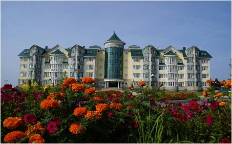
Eastern area with the center in the village. Maloyaz (sanatorium "Yangan tau" with the complex being built ski slopes and infrastructure for it);
Eastern area with the center in the cities Sim andAsha of Chelyabinsk region. Sitting Area, amateur tourist routes and the place of training climbers, mountain climbers and tourists. In recent years, Asha and Minyar actively cultivated skiing.
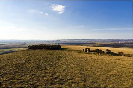
South-Ural area with the center in Beloretsk area. Here are concentrated the main routine and amateur tourist routes, which have been developed up to 1990, some of them are functioning today (meaning the routes organized by the type of rest). In recent years, Beloretsk Abzelilovsky District and became the center of the ski tourism. There are built and operated GLTS "Abzakovo" and "Metallurg-Magnitogorsk" ski slope in Beloretsk, in the district there are two tourist centers of Joint Stock Company "BASHTUR". The area is bordered by Burzyansky District, which is known Burzian Reserve and the famous cave Shulgantash with cave paintings of primitive man.
Green (halal) route
Compliance with "Halal" standards; environmental friendliness; emphasis on the contemplation of natural beauty and a visit to the holy places; familiarity with the traditional Russian Islam; Dive into the depths of history, the history and culture of the Bashkir people; treatment by natural factors.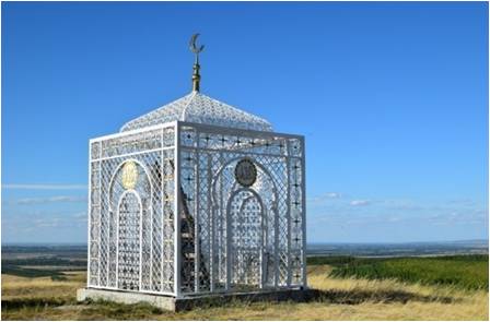
Minerals
In Bashkortostan there are deposits of oil (about 200 Rounds fields), natural gas (projected reserves of over 300 billion cubic meters), coal (about 10 fields, reserves of 0.5 billion tonnes), iron ore (more than 20 fields, reserves of about 100 million tons), copper (15 fields) and zinc, gold (more than 50 fields), salt, cement raw material quality.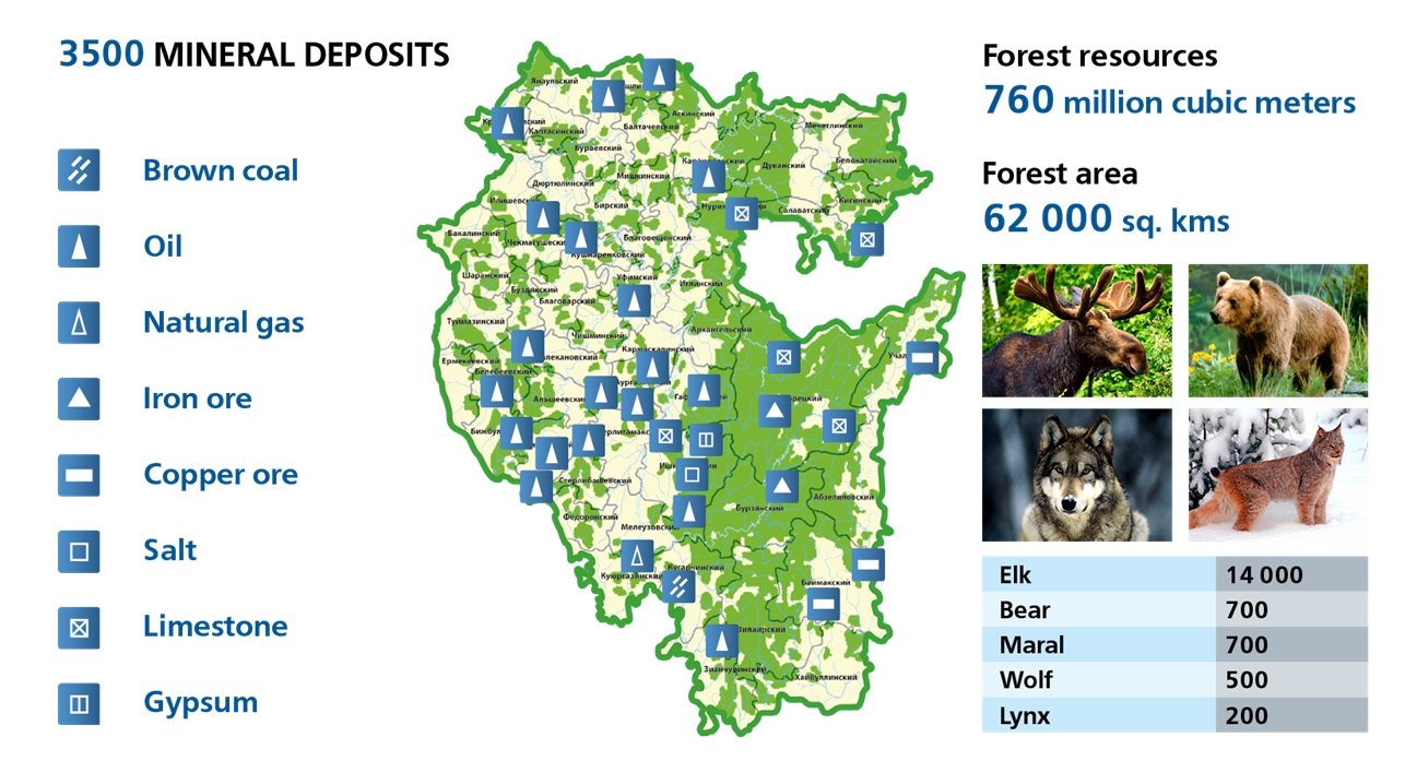
Oil and gas
Oil deposits are common throughout the country, but the largest and most numerous of them are concentrated in a few areas of oil and gasTuimazinskaya-Shkapovsky (west and south-west), Arlan-Kushnarenkovsky (Birsk saddle and the Annunciation of the depression, the north-west)
Bashkir vault (north), the Annunciation depression and southeast slope of the South Tatar crest (center, south)
the Ural region of deflection (east southeast).
Tuymazinskoe, Seraphimovskoe, Shkapovskoe deposits are located in the vast elevated structural zone, extending also to the neighboring Tatarstan and the Orenburg region.
Arlanskoe, Mancharovskoe and other deposits are controlled by on-board zones Aktanysh-Chishminsky trough Kama-Kinel system and are mainly associated with clastic strata of the Lower Carboniferous.
The Bashkirian arch area of the oil fields developed in the central part (Kushkulskoe). For more than 20 fields (Orebash, Igrovka, Buraeva, Kuzbaevo, Chetyrman, Yugamash, Tatyshly, Voyady et al.), To mark the reefs and structures oblekaniya board zones Shalymskogo trough north-western slope and the adjacent part of the Upper Kama depression centered.
In the area of the Annunciation basin and south-eastern slope of the South Tatar crest deposits controlled by graben deflections and associated valoobraznymi narrow zones (Demskoe, Sataevskoe, Rajewski, Sergeevskoe).
In the Ural basin small, but numerous oil, gas and dual deposits controlled by reef arrays and linear anticlines (Kinzyabulatovskaya, Karlinskaya).
In the context of the platform cover of the oil reservoir located at several age levels.
Most of the oil fields - high-rise, their constituent deposits are located within the contour of the oil-bearing averaged at different stratigraphic levels. The platform of the multilayer fields predominate. Within the Ural Trough - deposits in reef arrays and linear folds kinzyabulagovskogo type installed oil-bearing Upper Devonian carbonate deposits (Tabynsk).
All the oil fields of the republic divided into 4 genetic types: structural, lithological, stratigraphic, reef (massive), with marked predominance of deposits of the first type.
Other fossil fuel
Distributed lignite deposits. The greatest value in this case is South Ural basin, whose territory covers the territory of the Bashkortostan and the Orenburg region.Reserves of coal in the country amount to 252.7 million tons. Their production led JSC "Bashkirugol" (closed in 1999). Maximum production accounted for 1975 (9.4 million tons, including production in the Orenburg region), it is now down to about 3.5 million tons (including 425,000 tons actually in Bashkortostan) in connection with the depletion of low-ash coal.
In Bashkortostan 34 explored deposits of brown coal, the most important are Babayevskoye, lighthouse, Kuyurgazinsky, South Kuyurgazinsky and Krivlevskoe, their total reserves amount to 25.4% of the reserves of the South Ural basin.
In the north-western part of Bashkortostan (Kama coalfield) opened by several layers of black coal capacity up to 20-25 m (estimated resources of about 20 billion tons).
The Urals in sediments domanikovskogo horizon Frasnian shale common. Some manifestations of shale oil deposits discovered in the Upper Carboniferous in the south-western edge of the plateau of Ufa.
Solid minerals
Distributed in the Urals, in the mountainous part of the Southern Urals and in the Urals, and are represented by deposits of copper, gold, iron ore, rock salt, fluorite, magnesite, barite, bauxite, and others.The republic mineragenic distinguish 3 zones:
1st zone Preduralsky deflection region with the platform adjacent to it. and the West-Ural zone of folding
2nd zone to Zyuratkul-Yuryuzanskogo fault
3rd Krakinskoy eastern part of the zone and Uraltauskogo anticlinorium
In the first area developed sedimentary deposits of rock salt salt-Sterlitamak-Salavatskaya province, gypsum and anhydrite deposits in Kungurian stage, manganese carbonate sediments of Early Permian and Carboniferous ages, phosphate rock in the Lower Permian carbonate rocks, copper and red-mottled Upper molasse deposits of bauxite verhnefranskih in carbonate deposits in Salavat area.
In the second zone of disseminated stratiform deposits of siderite, magnesite, barite and base metals. There are deposits of natural brown iron alloy. Along the major faults are common manifestations of numerous lode gold and placer and fluorite.
In the third zone of disseminated numerous small deposits and occurrences of copper and chromite.
In 2006, 3.2 million tons of chalcopyrite ores were mined in the territory of Bashkortostan, 45,8 thous. Tons of copper, 97.1 thous. Tons of zinc, 5132 kg of gold, 76.8 tons of silver. Since oxidized gold ores produced 932.8 kg of gold, alluvial gold - 70 kg. salt production amounted to - 3.5 million tons of limestone for the chemical industry - 4.3 million tons of gypsum - 80 thousand tons, cement clays - 660 thousand tons of facing stone (granite) - 20 thousand cubic meters.
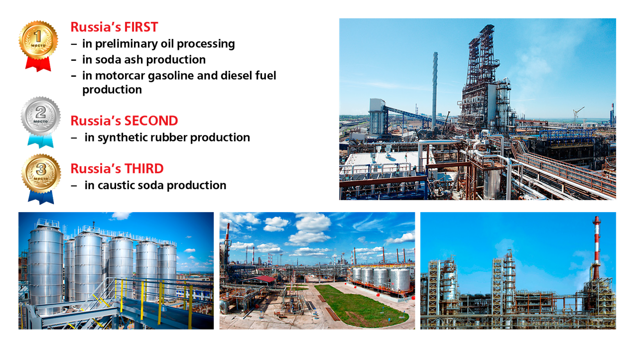
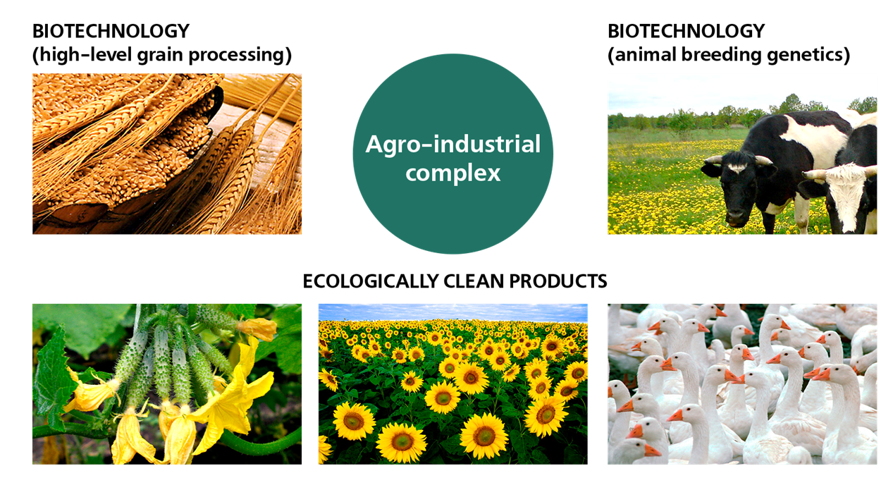
Industry of Bashkortostan
Developed industrial sector
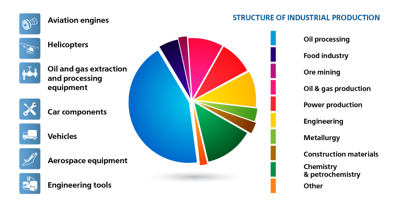
Leader of Russian petrochemistry
High technologies of ingineering


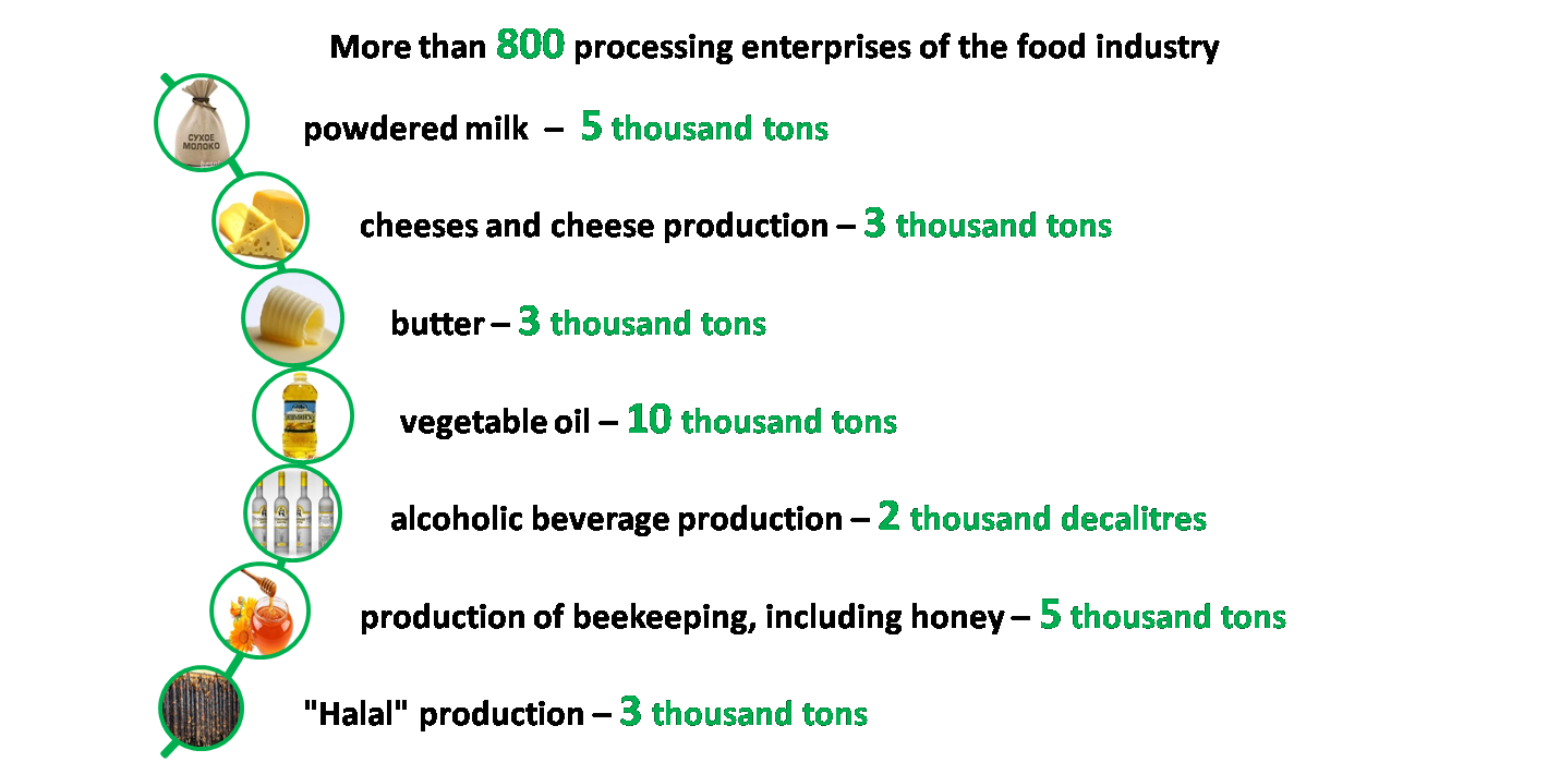
Agrosector
Developed agricultural sector
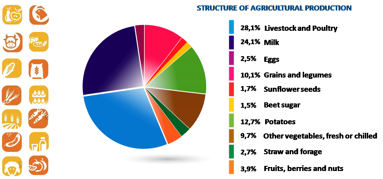
Agroindustrial complex
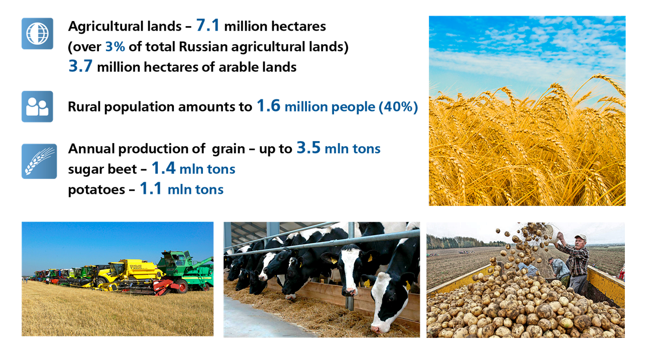
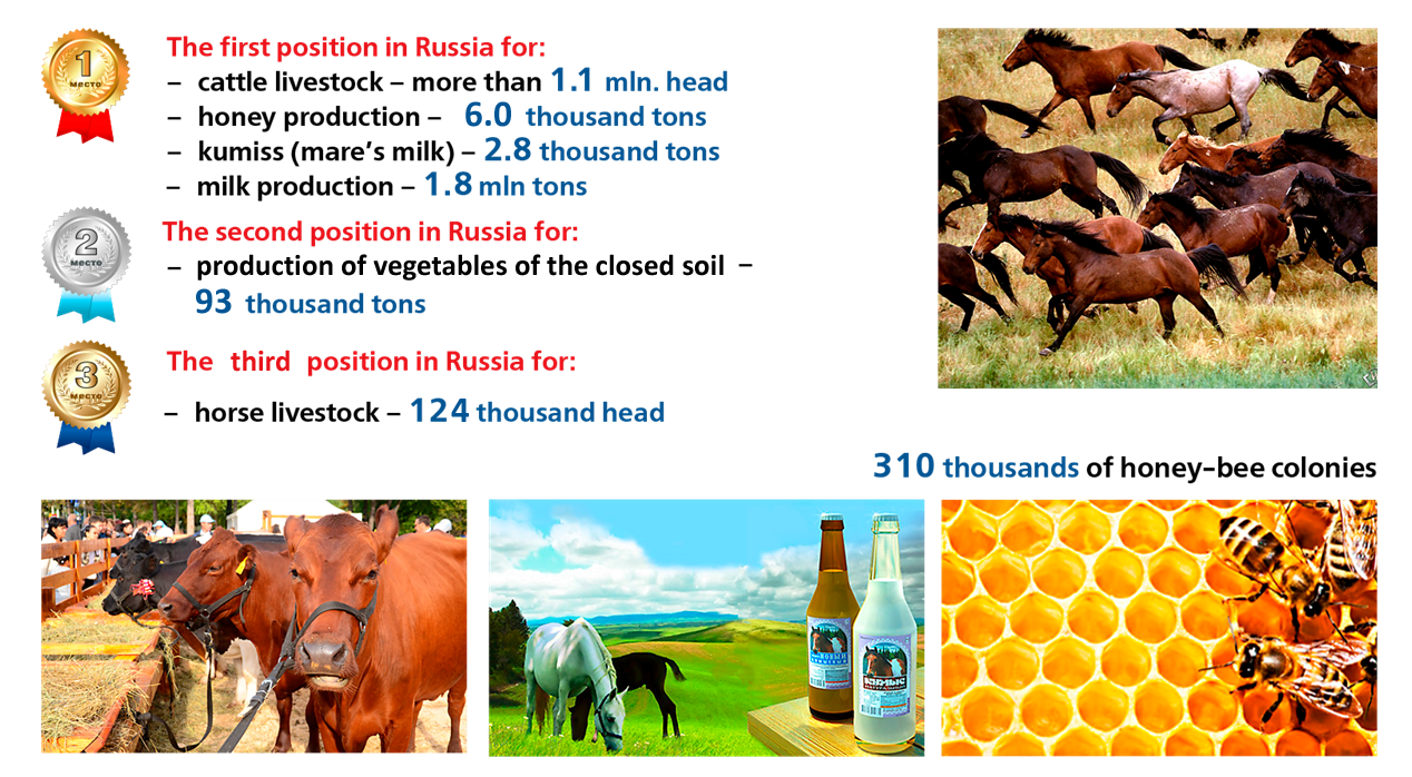
Export potential of agriculture
Growing points


History of Bashkiria
Ancient period
The very first monument of human habitation on the territory of modern Bashkortostan, relating to the period of the early and middle Paleolithic is parking Mysovaya near Lake Karabalykty in the Urals, where the various tools used by man were found: Hand ostrokonechniki, chopped, chips, a variety of products from local stone rocks.
The territory of the Southern Urals (Bashkiria and present in particular) was characterized by an abundance of vegetation, livestock and stone materials, and attracted people from different areas (including quite remote).
Shulgan-Tash Cave (Capova Cave) in the upper reaches of the river and the White Ignatievskaya (Yamada-Tash) in the upper reaches of the river Sim belong to the Upper Paleolithic period. On the walls of the cave, different images of rock art have been found (silhouette images of mammoths, horses and other animals).
In the Mesolithic era (12-7 millennium BC) there was a significant increase in population in the present territory, as evidenced by various archaeological sites of this period in the Bashkir Trans-Ural (eg, parking Yangelka, Murat, Yaktykul). The racial type of the local population of that period was a Caucasoid Mongoloid features.
At the same time there is a development of the productive forces, as evidenced by the finding of the plate technology for the production and use of more sophisticated tools. This period is the time of assigning the domination of the economy - hunting, fishing and gathering.
In the Neolithic Age (6-4 millennium BC. E.) There is a transition from appropriating the generating farming and ranching economy, but it slows down the climatic conditions and fishing was the most rational activity. During this period, also it develops widespread production of pottery. Also manufactured silicon guns, the most common among them are scrapers, knives and guns hunting tips. Also sverlёnye axes, chisels were found, various ornaments.
In the Eneolithic (end of the 4th - beginning of the 2nd millennium BC..) Continues the development and interaction of arrays formed before the population of the Southern Urals. During this period the local population bred sheep and cattle. It is believed that in these places was first domesticated the horse.
Since the mid-2 at the beginning of the 1st millennium BC. e., in the Bronze Age, began a period of intensive development of the Southern Urals, and is associated with the arrival here Abashevo tribal culture. Abashevtsy had high bronze processing, production of her tools. shepherd's economic-cultural type of activity, as well as stationary settlement was established.
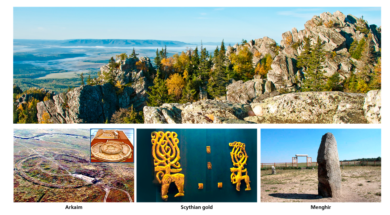
During the formation of Timber Grave-Andronovo Antiquities (16-15 century BC). There are settlement and burial structures, indicating a deepening of social heterogeneity of society (the rich burial of leaders and emerging military aristocracy) and the consolidation of various groups in large tribal community. A striking evidence of these processes is the development of villages Balanbash, Tyubyak, Sintashta, Mouth, Arch and others.
In the last century BC, has developed public education Kangyuy, subjugate and tribes living on the territory of Bashkortostan.
In 5-8 centuries there developed bahmutinskaya, turbaslinskaya Kushnarenkovsky and culture, dating back to the culture Kangui.
Protohistory
The first written mention of the Bashkir tribes found in Herodotus (V century BC).The first mention in the "Bashgurd" form for the terrain (mountains and province) refers to the VIII century.
The name of the people - "bashkort" - was first mentioned in the writings of Sallam Tardzhemana (first half of the IX century). About country Bashkirs, its people and customs reported in IX-XIII centuries, Arab geographers Ahmed Ibn Fadlan and al-Balkhi, an Italian monk Plano Carpini and Dutchman Willem Rubruk. Ibn-Rust noted that the Bashkirs - "an independent nation, which occupies the territory on both sides of the Ural mountain ridge between the Volga, Kama, Tobol and upstream of Yaik." A geographer Idrisi in the XII century, wrote about the two areas of Bashkirs "inner" and "outer" and mentioned the Bashkir city Nemzhan, Gurkhan, Karaki, Qasr and Masri said.
Since the second half of the XVI to the beginning of the XIX century Bashkirs occupied land from the left bank of the Volga, in the south-west to the upper reaches of the Tobol in the east, from the north to the river Sylvyna middle reaches of Yaik in the south.
In X-XIII centuries. western part of the Bashkirs was part of the Bulgarian Khanate. With the X century Islam spreads among Bashkirs, who in the XIV century the dominant religion.
The first battle with the Mongols Bashkirs took place in 1219-1220, When Genghis Khan led a huge army spent the summer on the Irtysh, where summer pastures were Bashkirs. The standoff between the two nations lasted for a long time.
From 1220 by 1234 the Bashkirs continuously fought with the Mongols, in fact, holding back the onslaught of the Mongol invasion in the east. Bashkirs repeatedly won the battle, and finally concluded a treaty of friendship and alliance. Mongolian-Bashkir war lasted 14 years (while trekking through Russia took only 3 years).
Bashkirs are entitled biystva (labels), that is actually a territorial autonomy within the empire of Genghis Khan. In the legal hierarchy of the Mongol Empire occupied a privileged position Bashkirs as a people bound kahans primarily military service and save your own tribal system and control, legally possible to talk only about the relationship of suzerainty-vassalage, instead of the "allied".
In XII-XIV centuries. all Bashkirs resettlement area was part of the Golden Horde. Ever since the formation of the Golden Horde in 1243 and up until 1391, that is, half a century on the territory of Bashkortostan Historical operated two "il" - Bashkir and Tabynsk controlled his princes - biys.
In August 1391 when the river Kondurcha hosted "Battle of the Nations." In the battle faced Army of two world powers of the time: the khan of the Golden Horde and Tokhtamysh Samarkand Emir Timur (Tamerlane). The battle ended with the defeat of the Golden Horde, put an end to the Bashkir autonomy as part of the Golden Horde.
After the collapse of the Golden Horde territory History of Bashkortostan became part of Kazan, Nogai, Siberian and Astrakhan khanate.
As a part of Russia
By 1557 it took place mostly voluntary integration of modern Bashkortostan in Russia. At the time of occurrence of the Bashkirs occupied territory from the middle reaches of the Tobol to the middle reaches of the Volga River. After the fall of Kazan Ivan IV appealed to the Bashkirs calling voluntarily enter into the Russian state. The first in 1554 to the royal governor in Kazan arrive after northwest Bashkir delivery (yryu) and pre-agreed conditions of entry.In 1554-1555 years in Kazan went to representatives of the central, southern and south-eastern Bashkirs (sort (yryu) Yurmaty, Burzyan, kypsak, Usergan, Tamyan).
In 1555-1556 years following the birth of Bashkir (yryu) went to Moscow for the so-called "grant charters", which laid out the terms of their entry into Russia. They stipulated the full right to dispose of Bashkirs their territory, to have her own army, administration, religion. Meanwhile, Russia committed itself to help the Bashkirs in repelling foreign aggression, for which Bashkirs had to pay tribute and to contribute troops to participate in defensive wars Russia.
About voluntary accession to Russia and getting Bashkirs said charters and chronicles elders Kidrasa Mullakaeva reported by P. I.Rychkovu and then published in his book "History of Orenburg": "... not only the land where they are before their citizenship, while still thinly populated and in extreme squalor live - namely, for Kamoyu the river and near the White Voloshko (Koya after with a white river called), they, Bashkirs, confirmed, but beyond that, and many others, in which they now permit, granted as testify zhalovannyya Charter, which many still exist. "
The exclusivity of the Bashkir and Russian relations is reflected in the "Cathedral Code" in 1649, where the Bashkirs under pain of confiscation of property, and the sovereign's disgrace forbidden "... boyars okolnichim and dumnyi people, and steward, and solicitor and nobles of Moscow and of the cities nobles and children knights and all ranks of the landed Russian people of any land not buy and do not change in the mortgage, and delivery and rentals for many years hath not. "
By the middle of the XVI century, after the collapse of the Siberian Khanate, in fact, it took the final entry of the territory of modern Bashkortostan in Russia.
Map: "The division of the province of Ufa and Bashkortostan on darugi" Landskarty Orenburg province "Krasilnikov, 1755.
The territory of Bashkortostan in the XVI-XVII centuries. in the royal documents designated as "Ufa county," which was divided into Nogai, Kazan, Siberian and Osinski road (darugi). Trans-Ural Bashkirs were part of the Siberian railway. Roads consist of tribal parishes, which, in turn, divided into clans (or tyuby aimags).
Daruga road or in this case, is considered as a kind of economic land use at the time.
Bashkiria at that time consisted of the following administrative units: Kazan daruga, Nogai daruga, Osinskaya daruga and Siberian daruga.
Each daruga ruled foreman.
Daruga in turn divided into townships. So let's say in the designation of a geographical object stated: Nagayskoy on the road, in the Kara-Tabynsk parish or better: in Bashkiria in the Siberian road to Murzalarskoy parish and so on. In 1708 the local region added to the Kazan province as the Ufa province [10], which was renamed in 1719 in Ufa province. In 1737 the Zauralskaya part of Bashkortostan has been attributed to newly created Iset province, whose territory encompassed modern Kurgan, north-eastern part of Chelyabinsk, the South - Tyumen, east - Sverdlovsk regions. In 1744 Empress Elizabeth imperial decree ordered "to be in the Orenburg province and cited Orenburg Province and it be the governor Neplyuev privy councilor." Orenburg Province was established as part of Orenburg, Ufa and Iset province. In 1744 Empress Elizabeth imperial decree ordered "to be in the Orenburg province and cited Orenburg Province and it be the governor Neplyuev privy councilor." Orenburg Province was established as part of Orenburg, Ufa and Iset province. Isetskaya province contained a trans-Ural Bashkiria and counties Iset, Lufia and Okunevskaya; Ufa province - counties Osinski, Birsk and Menzelinsky.
In 1774 Ufa Province moved into the set up of the Orenburg province.
In 1781 Ufa governorship consisted of two areas, Ufa and Orenburg. In 1796 Ufa governorship renamed in Orenburg province.
Canton of reform in 1798 marked the end of the operation of roads. Since then, the petitions were specified province, district, rooms Bashkir cantons and military Yurtov (teams).
In 1865, he established the division of Ufa Province Orenburg Province in the Ufa and Orenburg, consisting of Ufa, Belebey, Birsk, Zlatoust, and Menzelinsky Sterlitamaksky counties.
Formation of Small Bashkiria
Main article: Bashkir Autonomous Soviet Socialist Republic of Bashkiria small cantons in September 1919.After the February Revolution of 1917 began the process of national movements in the region for the creation of a national-territorial autonomy. In July-August 1917 in Orenburg held Vsebashkirskie I and II conventions (kurultais) where the decision was made about the need for "a democratic republic on the national territorial basis" as part of a federal Russia. Elected and re-elected first to the second congress of the Bashkir regional (central) Shuro (Board) has worked in Orenburg, and was preparing for the Russian Constituent Assembly, which was held in January 1918.
The October Revolution has made adjustments in the process of becoming autonomous. November 16, 1917 Bashkir regional (central) Shuro (Council) proclaimed part of the territories of the Orenburg, Perm, Samara, Ufa provinces an autonomous part of the Russian Republic - territorial and national autonomy Bashkurdistan. The latter decision was approved at the III Vsebashkirskom Congress (Kurultai), which was held 8-20 December 1917 in Orenburg.
The concept of "Small Bashkiria" was introduced in January 1918, during the development of the project "Provision of Malaya Bashkiria autonomy". The composition of the Little Bashkiria were classified southern Krasnoufimsky (Perm Province), southern Osa (Perm Province), south-east of Yekaterinburg (Perm Province), south-western Shadrinsk (Perm Province), south-west of Chelyabinsk (Orenburg province), western Trinity (Orenburg province) Verkhneuralsk (Orenburg province), north-west of Orsk (Orenburg province), north of Orenburg (Orenburg province), south-western Birsk (Ufa province), north-eastern part of Sterlitamaksky counties (Ufa province), east Buguruskansky ( Samara province). Estimated: area - 78 439 sq km, population - 1,219,900 people.
March 20, 1919 the "Agreement of the central Soviet government with the Bashkir government about Soviet Autonomous Bashkiria". The press published March 23, 1919, therefore, the official date of the republic of education is considered to this day. In accordance with the "Agreement ..." Bashkir Autonomous Soviet Republic (ABSR) was formed. The term "Malaya Bashkiria" to continue to apply in respect ABSR.
According to the "Agreement ..." the whereabouts of the Bashkir Autonomous Soviet Republic capital was to determine the Congress of Soviets. In connection with the advent of the republic's leadership Kolchaka (Bashrevkom) were evacuated in Saransk, where there were at the end of April in August 1919. August 20, 1919 Bashrevkom back in town Sterlitamak, which became the de facto capital of Malaya Bashkiria, staying on the territory of Ufa province. August 20, 1920 the city of Sterlitamak, and in November of the same year and 16 townships Sterlitamaksky County passed in the republic.
Formation of Great Bashkiria
June 14, 1922 the All-Russian Central Executive Committee, taking into account the wish of the Bashkir people, adopted a decree "On the extension of the Bashkir Autonomous borders of the Socialist Republic." According to this decree Ufa Province was abolished and its territory was transferred Bashkir Republic. The capital city of the Republic of Sterlitimak transferred to Ufa.The Soviet period
Areas of the Tatar and Bashkir Autonomous Soviet Socialist Republic in 1953During the Great Patriotic War in Bashkortostan were evacuated more than 100 industrial enterprises, dozens of hospitals, the number of central government agencies, 278 thousand refugees (of which 104 thousand - Ufa).
In May 1952, the Bashkir Autonomous Soviet Socialist Republic was divided in Ufa and Sterlitamak area. In April next year, this decision was reversed and the regional division in the Bashkir Autonomous Soviet Socialist Republic was abolished.
October 11, 1990 Bashkir Autonomous Soviet Socialist Republic was the Bashkir SSR (Declaration of State Sovereignty of the Bashkir SSR). Republic remained a part of the RSFSR. During the Emergency Committee chairman BASSR Supreme Council opposed the putsch.
Formation of Republic of Bashkortostan
October 11, 1990 the Supreme Council of the Republic was proclaimed the Declaration on State Sovereignty. March 31, 1992 Bashkortostan signed a federal agreement on the delimitation of powers and terms of reference between the Russian Federation state authorities and authorities of sovereign republics in its composition and its Annex of the Republic of Bashkortostan, which determined the nature of the contractual relations of the Republic of Bashkortostan and the Russian Federation. The Annex to the Agreement for the Republic establishes the right to have an independent legal system, the judiciary and the prosecutor's office. It was also noted that the land, mineral resources, natural resources in the territory of Bashkortostan are the property of the multinational people of Bashkortostan, and that the issues of ownership, use and disposal of property governed by the laws of the republic.December 12, 1993, Murtaza Rakhimov was popularly elected as the first President of the Republic of Bashkortostan, in 1998 and 2003 he again re-elected to this post.
In October 2006, Russian President Vladimir Putin has submitted the candidacy of Rakhimov to the local parliament, which confirmed him in office until 2011. July 15, 2010 President of Bashkortostan Murtaza Rakhimov resigned.
July 19, 2010 the State Assembly - Kurultai of the Republic of Bashkortostan Rustem Z. Khamitov approved in the position of President of the Republic of Bashkortostan.